Tuesday, July 1, 2014

Clearlake, the Forgotten Gem

Road Trippin’
with  Steve McCarthy

So, Clearlake. A forgotten gem. Last month, I gave you a preview of what became a great drive. Here’s some details.

The lake itself is the largest fresh water lake in California. Tahoe is half in Nevada, and the Salton Sea is, well, salt water. There has never been an Interstate nor a railroad in Lake County. Lake County was the pre-prohibition Wine Country of NoCal. They have wineries there again and pretty damn good ones at that! They have DIAMONDS there! Well, it’s a kind of crystal, harder than most crystals, softer than real diamonds. The area also has a funky vibe to it, a cross between ranches, slightly tattered resort motor inns, aging hippies, more than a few “tweakers”, and a lot of Great Driving Roads.
We’ll start our specifics in San Rafael, above Frisco. Shoot over to the Marin French Cheese Company and maybe up the road to the Nicasio Cheese place for some munchies to have along the way. You won’t regret it. We then scoot through Petaluma, which deserves more than a glance. It has great Victorian houses and a vibrant Old Town. From there, through Santa Rosa and up over Hwy. 29 to Calistoga. Stop at the Petrified Forest along the way. Interesting stuff there, and a bit of California History.
From here, it’s through Calistoga, one of our favorite towns and just outside of town is the Chateau Montelena Winery. This is one of the world’s best. Do a CAREFUL tasting (let your navigator have most of the fun) because the road up and over the volcano (!!) is tight and twisty and takes full concentration. Once over the top, you’ll hit Middletown (‘cause it’s halfway between Calistoga and Clearlake) and detour to the Guenoc/Langtry Winery. This is one of the oldest in Lake County. Some exceptional wines here too.


Then, it’s through Clearlake (on our trip there we stayed at the very nice Best Western and got upgraded to a freakin’ SUITE!) and to the Featherbed Inn. This would be our future choice of lodgings. The “rooms” are old cabooses (cabeese?) and each has a theme (dibs on the “Casablanca” one) and HOT TUBS! There seem to be some good eateries along the main road for dinner, take your pick!


For the next day, tour the lake. Take a lap, as it were. There are several neat little towns like Nice, Lucerne, Upper Lake, Lakeport, and Kelseyville. Each has it’s charms and plenty of Antique Shoppes to search for Clearlake Diamonds in. Most of ‘em have ‘em, they ain’t expensive and kinda cool. There are a lot of wineries around, we highly recommend Steele near Kelseyville. GREAT Zinfandel! Again, all along the way are great little diners, try one for lunch! I'm reliably informed by one of my agents, that the Saw Shop Gallery-Bistro is a very nice place. A step up (or 12) from the usual diner. Or, better yet, remember that cheese and stuff you bought? Hope you brought it with you! A picnic lunch at the McVicar Wildlife Sanctuary is just the ticket. Peaceful, great views, good cheese, good wine, good eats…


The last real stop is the best winery on the route. Ceago. WOW, is all I can say. Wander the grounds, smell the lavender, taste the wine. This place is amazing. Right on the lake, you’d swear you were in Tuscany. It’s also a short hop back to your caboose. Now, before you get all heated up, I will tell you that these wineries are NOT $2 Chuck! These are generally over $20/bottle, some a lot more. They ARE good. They ARE worth buying, and most are meant for laying away for a few more years. Ceago has begun (or maybe picked up on) a trend towards Cabernets with a heavier mix of “Franc” grapes. Franc is like Merlot, usually meant to blend with Cabernet to add complexity. With the over saturation of Merlots on the market (and frankly, most Merlots are bland. They are meant for people who really don’t like good wines, but want to seem like they do) some wineries are turning to Franc wines as a new direction. The time to get these is NOW. Before they become “known” and every bulk wine maker out there starts throwing indifferent slop at you. The Ceago Cabernet Franc is a spectacular wine!
This whole area is worth some exploring. And, it’s close enough to the North Coast for a more extended trip. Lots of great roads, not a lot of traffic, great scenery, and great wines. Give Lake County a look. You won’t regret it.

1. North on US-101 N via the ramp to Eureka 10.6 mi
2.  Take the Atherton Ave exit toward San Marin Dr 0.2 mi
3. Turn left onto Atherton Ave 0.2 mi
4.  Continue onto San Marin Dr 2.7 mi
5. Turn right onto Novato Blvd 6.3 mi
6. Turn left onto Point Reyes Petaluma Rd 0.4 mi
7. Turn right
Destination will be on the right 230 ft
21.2 mi – about 29 mins

Marin French Cheese
7510 Point Reyes Petaluma Road
Petaluma, CA 94952

9. Head northeast toward Point Reyes Petaluma Rd 230 ft
10. Turn left onto Point Reyes Petaluma Rd 4.8 mi
11. Continue onto D St/D street Extension
Continue to follow D St 4.4 mi
12. Turn left onto Lakeville St 0.1 mi
13.  Take the 1st right onto E Washington St 0.8 mi
14. Take the ramp onto US-101 N 20.0 mi
15. Take the River Rd exit toward Guerneville 0.2 mi
16. Turn right onto Mark West Springs Rd 5.3 mi
17. Continue onto Porter Creek Rd 4.7 mi
18. Turn left onto Petrified Forest Rd 4.4 mi
19. Turn left onto CA-128 W/Foothill Blvd 0.8 mi
20. Turn right onto Tubbs Ln
21. Destination will be on the left 1.1 mi
46.7 mi – about 1 hour 2 mins
Chateau Montelena Winery
1429 Tubbs Ln
Calistoga, CA 94515

22. Head northeast on Tubbs Ln toward CA-29 S 0.2 mi
23. Turn left onto CA-29 N 15.5 mi
24. Turn right onto Butts Canyon Rd
Destination will be on the left 5.7 mi
21.4 mi – about 30 mins
Guenoc & Langtry Vineyards
21000 Butts Canyon Rd
Middletown, CA 95461

25. Head west on Butts Canyon Rd toward Oat Hill Rd 5.7 mi
26. Turn right onto CA-29 N 13.9 mi
27. Continue onto CA-53 N 7.4 mi
28. Turn left onto CA-20 W 18.3 mi
29. Slight left onto Nice-Lucerne Cutoff Rd 328 ft
30. Continue onto Lakeshore Blvd
Destination will be on the right 0.2 mi
45.6 mi – about 1 hour 0 mins
Featherbed Railroad Bed & Breakfast Resort
2870 Lakeshore Blvd
Nice, CA 95464

DAY TWO
31. Head west on Lakeshore Blvd toward Collier Ave 0.2 mi
32. Take the 1st right onto Collier Ave 0.2 mi
33. Slight right to stay on Collier Ave 338 ft
34. Take the 1st left onto CA-20 W 0.7 mi
35. At the traffic circle, continue straight to stay on CA-20 W 3.4 mi
36. Turn right onto Main St 0.2 mi
37. Take the 1st left onto 1st St 446 ft
38. Turn left onto Mendenhall Ave 0.2 mi
39. Turn right onto CA-20 W 0.5 mi
40. Turn left onto CA-29 S 13.7 mi
41. Turn left onto Thomas Dr
Destination will be on the right 279 ft
19.2 mi – about 25 mins
Steele Wines Inc
4350 Thomas Dr
Kelseyville, CA 95451

42. Head north on Thomas Dr toward Argonaut Rd 0.4 mi
43. Continue onto Big Valley Rd 0.4 mi
44. Slight right onto Stone Dr 0.8 mi
45. Turn right onto Soda Bay Rd 2.7 mi
46. Turn left to stay on Soda Bay Rd 2.9 mi
47. Head east on Soda Bay Rd toward Bergesen Dr 6.7 mi
48. Turn left onto Point Lakeview Rd 4.7 mi
49. Turn left onto Walnut Ln
Destination will be on the left 0.1 mi
11.5 mi – about 20 mins
McVicar Wildlife Sanctuary
Lower Lake, CA 95457

50. Head southwest on Walnut Ln toward Point Lakeview Rd 0.1 mi
51. Turn left onto Point Lakeview Rd 2.2 mi
52. Turn left onto CA-29 S 1.9 mi
53. Turn left onto CA-53 N 7.4 mi
54. Turn left onto CA-20 W
Destination will be on the left 16.0 mi
27.6 mi – about 38 mins
CEAGO WINERY & BIODYNAMIC FARM
5115 California 20
Nice, CA 95464

55. Head northwest on CA-20 W toward Bartlett Springs Rd 2.3 mi
56. Slight left onto Nice-Lucerne Cutoff Rd 328 ft
57. Continue onto Lakeshore Blvd
Destination will be on the right 0.2 mi
2.6 mi – about 5 mins
Featherbed Railroad Bed & Breakfast Resort
2870 Lakeshore Blvd
Nice, CA 95464


Friday, May 30, 2014

What's a Few Hours, Anyway?

Road Trippin’
with Steve McCarthy

What’s two hours worth? Lot’s of answers to that. Time with a newborn? Priceless. At the higher minimum wage that people are screaming for? About $30. Before taxes. On a Road Trip? It’s the difference between a mind stultifying endless slog up the I-5 and the FAR more pleasant cruise up the 101. Two whole freakin’ hours longer. That’s it. It’s the difference between eating McKing Jr. and a Bison Burger in Atascadero. It’s the difference between a Denny’s pancake and waffles at the Worker Bee in Carpinteria. It’s the difference between rolling hills, dotted with oak trees, a road that gently sweeps through vineyards and rich farmland and the cattle pens in Kettleman City. It’s the difference between a parade of semis, limited to 55 mph trying to pass each other at 57 mph, while some sanctimonious asshat in a Prius hogs the fast lane at 65, “Saving the Planet.” So, what brought all this on?
One of our dearest friends, Pam is about to become one of our Oldest Friends. She’s hitting 60. As in years, not MPH. Sixty is a rough one. It's the age when you know you are all of a sudden, "Old." There's a tendency to look backwards. A lot. To need to reconnect with people from one's past. A tendency to reflect on what you've done with your life. It marks the point when you're starting the last of your Biblically allotted "Four Score Years." The crappy part is, it's like hitting 20, when you're not a teen, can vote, but can't drink. At 60, you're not old enough for Social Security or Medicare, but old enough for the Senior Menu and Discounts.
        Marianne and Pam had babies together, shared baby sitting duties, breast feeding advice, and swapped lies about their husbands. Bill, Pam’s husband at the time is perhaps my dearest and oldest friend. Pam is coming south from Washington to Clearlake, where Bill lives, to celebrate with their kids and friends. We are going. Instead of doing the Southwest Tour I talked about, we’re heading for the wine country, then to the NoCal Coast. Not a bad trade off. Naturally, that means making a choice of route.

Good Ol’ Google Maps naturally defaults to the I-5 north, then cutting west above Sacramento to Clearlake. Some 494 miles. Seven hours, eighteen minutes of driving time. The alternate Central Valley Route of Hwy. 99 is 498 miles and about a half-hour longer. At least along the 99 there are places to stop to eat that don’t involve crappy fast food (WOW, there’s a redundancy if ever there was one!). But mostly, each is an unending panorama of flat farmland, offering little in variety. At least on the 99 you might spot a train or two, and get to tick off the towns as they roll by. Bakersfield, Delano, Pixley, Tulare, Kingsburg, Fresno, and on and one. This was the route we’d take to see the Grand Folks in Sacramento. Then at least, each small town was a separate, distinct entity. Now, they are rapidly growing together.
Then, there’s that two hour difference. US Highway 101. The El Camino Real. The King’s Highway. The ORIGINAL California Road Trip Route. An investment of two hours is all it takes to see the quintessential California landscape. Rolling hills, oak trees, Pacific Ocean, missions, and great food. Now, because there’s more to see, you might windup spending more time poking about. Is that a bad thing? So you add another hour or two? Look at what you gain!
Time, therefore, is not merely money. Time is experiences. The more time you take poking about, the richer your life is. Richer in far more permanent ways than mere money.

1,267 miles, 22 h 40 min
Monrovia, CA

1. Merge onto I-210 W 8.3 mi
2. Continue onto CA-134 14.1 mi
3. Merge onto US-101 N 72.1 mi
4. Take the Casitas Pass Road exit 0.2 mi
5. Turn left onto Casitas Pass Rd 0.2 mi
6. Turn right onto Carpinteria Ave 0.3 mi
7. Turn left onto Linden Ave
Breakfast Destination will be on the right 131 ft
96.1 mi / 1 h 36 min
The Worker Bee Café
973 Linden Ave, Carpinteria, CA 93013

8. Head northeast on Linden Ave toward Carpinteria Ave 0.3 mi
9. Sharp right to merge onto US-101 N 0.1 mi
10. Merge onto US-101 N 152 mi
11. Take the Leavesley Rd/CA-152 W exit 0.4 mi
12. Merge onto San Ysidro Ave
13. Destination will be on the right 0.3 mi

Garlic Shoppe
8650 San Ysidro Ave, Gilroy, CA 95020


14. Head southeast on San Ysidro Ave 0.3 mi
15. Turn right onto Leavesley Rd 210 ft
16. Merge onto US-101 N via the ramp to San Jose 30.7 mi
17. Take the exit onto I-880 N toward Oakland 40.3 mi
18. Merge onto I-80 E 3.5 mi
Keep right to continue on I-580 W,
follow signs for San Rafael/Point Richmond
Partial toll road 13.2 mi
20. Take the exit onto US-101 N 11.9 mi
21. Take the Atherton Ave exit toward San Marin Dr 0.2 mi
22. Turn left onto Atherton Ave 0.2 mi
23. Continue onto San Marin Dr 2.7 mi
24. Turn right onto Novato Blvd 6.3 mi
25. Turn left onto Point Reyes Petaluma Rd 0.4 mi
26. Turn right
Destination will be on the right 230 ft

112 mi / 1 h 55 min
Marin French Cheese
7510 Point Reyes Petaluma Road, Petaluma, CA 94952

27. Head northeast toward Point Reyes Petaluma Rd 230 ft
28. Turn left onto Point Reyes Petaluma Rd 4.8 mi
29. Continue onto D St/D street Extension
Continue to follow D St 4.4 mi
30. Turn left onto Lakeville St 0.1 mi
31. Take the 1st right onto E Washington St 0.8 mi
32. Take the ramp onto US-101 N 0.2 mi
33. Merge onto US-101 N 19.8 mi
34. Take the River Rd exit toward Guerneville 0.2 mi
35. Turn right onto Mark West Springs Rd 5.3 mi
36. Continue onto Porter Creek Rd 4.7 mi
37. Turn left onto Petrified Forest Rd 4.4 mi
38. Turn left onto CA-128 W/Foothill Blvd 0.8 mi
39. Turn right onto Tubbs Ln 1.3 mi
40. Turn left onto CA-29 N 29.4 mi
41. Continue onto CA-53 N 2.9 mi
42. Turn left onto Lakeshore Dr
43. Destination will be on the left 0.4 mi
79.7 mi / 1 h 46 min
Best Western El Grande Inn
15135 Lakeshore Dr, Clearlake, CA 95422

Day Two
OK, from here on, you’re kinda on your own. I’ve traced out a route that hits some neat stuff. The Skunk Train, Fort Ross, The Roaring Camp and Big Trees RR, all manner of things to see along the way. Somewhere, you’ll need to stop for the night. I’ll let you figger it out, that’s what we’ll be doing. Take a chance! Same is true with places to eat. There are all manner of great places you can find along the way. I also used the Freeways to detour around Frisco. If you WANT to, head across the Golden Gate Bridge and see what the locals like to call The City. For all it’s snobbishness, Frisco DOES have great food! Above all, Relax and Enjoy! After all, what’s a few hours here or there?

1. Head east on Lakeshore Dr toward W 40th St 0.3 mi
2. Take the 1st right onto CA-53 S 3.0 mi
3. Turn right onto CA-29 N 30.8 mi
4. Turn left onto CA-20 W 18.9 mi
5. Take the ramp onto US-101 N 16.1 mi
6. Turn left toward Coast St 236 ft
7. Turn left onto Coast St 302 ft
8. Take the 1st right onto Pine St 135 ft
69.2 mi / 1 h 18 min
Willits, CA

9. Head east on Pine St toward Coast St 135 ft
10. Turn right onto Coast St 0.2 mi
11. Slight right to stay on Coast St 0.3 mi
Take the 3rd right onto CA-20 W/
Fort Bragg Rd/Fort Bragg-Willits Rd
Continue to follow CA-20 W 32.6 mi
14. Turn right onto CA-1 N/S Main St 1.8 mi
15. Turn right onto E Laurel St 197 ft
16. Turn left 85 ft
34.9 mi / 51 min
Fort Bragg, CA

17. Head south toward E Laurel St 0.1 mi
Turn right at the 2nd cross street
onto E Redwood Ave 207 ft
19. Turn right to stay on CA-1 S 24.4 mi
20. Turn right onto CA-1 S/Main St
Continue to follow CA-1 S 72.5 mi
21. Continue onto Valley Ford Rd 3.3 mi
22. Turn left onto Roblar Rd 6.5 mi
23. Turn right onto Stony Point Rd 3.4 mi
Turn left to merge onto US-101 S 0.2 mi
25. Merge onto US-101 S 25.9 mi
26. Take the Interstate 580 exit 0.5 mi
Merge onto I-580 E
(signs for Richmond Bridge/Oakland) 13.1 mi
28. Merge onto I-580 E/I-80 W 3.8 mi
29. Take the exit on the left toward Alameda/San Jose 1.5 mi
30. Merge onto I-880 S 44.3 mi
31. Continue onto CA-17 S 22.9 mi
Take the Mount Hermon Road exit
toward Felton/Big Basin 0.2 mi
33. Turn right onto Mt Hermon Rd 3.5 mi
34. Turn left onto Graham Hill Rd 0.5 mi
35. Slight right
Destination will be on the right 0.5 mi
247 mi / 5 h 20 min
Roaring Camp Railroads
5401 Graham Hill Road, Felton, CA 95018

1. Head northeast 0.3 mi
2. Turn right toward Graham Hill Rd 0.1 mi
3. Turn right onto Graham Hill Rd 5.0 mi
4. Continue onto Ocean St 0.3 mi
5. Turn left onto Plymouth St 0.1 mi
6. Keep left to stay on Plymouth St 135 ft
7. Merge onto CA-1 S via the ramp to Watsonville 476 ft
8. Merge onto CA-1 S 17.8 mi
9. Take the exit toward Salinas Rd 0.3 mi
10. Turn left onto Salinas Rd
11. 1.3 mi
12. Slight right onto Werner Rd 0.2 mi
13. Turn right onto Elkhorn Rd/Hall Rd
Continue to follow Hall Rd 3.6 mi
14. Turn right onto San Miguel Canyon Rd 4.6 mi
15. Merge onto US-101 S via the ramp to Vierra Canyon Rd
 From the 101, I’m sure you can get home!

Friday, May 9, 2014

Road Trippin'--The South West!

Road Trippin’
with Steve McCarthy

Before I get started, I have a shameless plug! Son of Road Trippin’ has been released! Yes, the Long Awaited Sequel to my first book, Road Trippin’ is now available. Autobooks will have copies as soon as they get printed, so get your copy NOW!
OK, I’ll be honest. This trip is a Leap of Faith. Well, most of it is. We’d planned on this Road Trip to be our Annual Trek, but other things have come up and well, it’s gonna be delayed. No worries, YOU can blaze the trail for us and let us know what worked! If you’ve done a few of our trips, you should be well seasoned by now, and able to roll with the punches. Realize that not everything goes as planned, you have to adapt on the fly, and you’ll be just fine.
I’d like to make a few suggestions for this journey. One, a GPS. These little things can be useful, especially if you’re hunting for a place to eat or rest your weary head. Two, a radar detector. Most states are using speed traps as revenue enhancement, so being forewarned is being forearmed! Three, Watch your fuel levels! A lot of this Trek is on LONG LONELY ROADS! Like Pee Breaks, never pass up an opportunity to top up from anything below half tank. Four, Bring stuff for picnic lunches! You will probably find neat places along the road to toss out a blanket and share a loaf of bread, some salami and cheese, and a nice view. Sure beats the Mickey D! Five, I’ve only suggested a couple of places to stay. Six-time of year. Unless you have great A/C, don't do this in the summer! Spring and Fall are best. Otherwise, find something local that fits your style and enjoy!
So, what’s this trip about? The Great Southwest! Lots of sand and cactii, lots of turquoise (!) and lots of spectacular scenery. There’ll also be a good hunk of history and enough funky stuff to keep you amused.
The first leg is a well known one. Get your kicks on Route 66. Try the Summit Inn at the top of Cajon Pass for breakfast, and maybe Mr. Ds in Kingman for lunch. Don’t gas up in Needles. They have the worst prices! Flagstaff will be the place to stop the night. There are a bunch of good motels near the old town, and the old part of Flagstaff has a ton of good places to eat and shop.
Next day, we’re headed south to Douglas, Arizona. Not much of a town, and a picnic lunch might be a good idea. Douglas isn’t much of a town, but the Gadsen Hotel is THE place to stop. It’s ancient, a bit funky, but has the largest TIFFANY STAINED GLASS WINDOW IN THE WORLD! I’ve so far only seen photos, but MAN this looks neat! Browsing about, it seems there are some good places to eat. I’m sure the hotel staff will recommend something. Or, let your fingers do the clicking.
The third day heads us to El Paso for BBQ and lunch. I pulled several possibilities from a local website and they all sound REALLY good! Pick one. It’s hard to go wrong with Texas BBQ! From there, it’s more of the Great American Desert to the funkiest place in the country, ROSWELL, NEW MEXICO!
Yes, folks, THAT Roswell. Of Alien Landing Fame. It’s a hoot. Tacky doesn’t do it justice. But even if you are a cynical unbeliever (like I am) this is a place you really have to see. Once. It’s High Kitsch! There’s museums (really gift shops) and alien crap everywhere. Go ahead. You know you want to!
From there on Day Four, it’s real history time. Tucumcari was an important place in the lore of the Wild West. Stop and see the stuff there. It was one of those great tourist traps in the days of Old Route 66.
After that, we’ll get artsy. Taos, NM is a haven for the creative. Take the time to poke around. After that, spend the night in Santa Fe. This is a great place, especially around the old town area. There are lots of places to eat and stay, so take your pick and enjoy.
Day five will take us to one of the most spectacular hotels in the world. The View is set smack dab in the middle of Monument Valley. Constant Reader will know we are obsessed by the beauty of this place. The hotel is fairly new (we haven’t had the pleasure of staying there, but reviews are excellent.), and reservations might be a good idea. It’s run by the local Native Americans.
If Monument Valley isn’t enough, the next couple of days will knock your socks off! Head up into Utah to the Arches, then Brice Canyon, then Zion. These are National Parks and will charge an admission fee. Some hiking may be involved so be prepared! The rock formations are incredible. You may want to build in an extra day or two, depending on how much exploring you want to do. There are motels and restaurants near each place.
From Zion, it’s a straight shot home on the good old I-15. Yeah, I know. But sometimes, you have to bite the bullet and just do it. Try not to waste time and any money you have left in Lost Wages!


The Easy part is the 210 to the I-15 North, Eat breakfast at the Summit Inn at the top of Cajon Pass. Then:

1. Keep right to continue on I-40 E, follow signs for Needles 49.9 mi
2. Take the exit toward Ludlow 0.3 mi
3. Turn right onto Crucero Rd 364 ft
4. Turn left onto National Trails Hwy 62.6 mi
5. Turn left onto Historic Rte 66 E 16.7 mi
6. Continue onto Goffs Rd 12.5 mi
7. Turn right onto US-95 S 6.5 mi
8. Turn left to merge onto I-40 E/US-95 S toward Needles 0.3 mi
9. Merge onto I-40 E/US-95 S
Continue to follow I-40 E
Entering Arizona 21.9 mi
10. Take exit 1 toward Golden Shores 1/Oatman 0.2 mi
11. Turn left onto Co Hwy 10/Oatman-Topock Hwy
Continue to follow Co Hwy 10 47.8 mi
12. Turn right onto Historic Rte 66 0.4 mi
13. Turn left to merge onto I-40 E toward Flagstaff 0.4 mi
14. Merge onto I-40 E 8.2 mi
15. Take exit 53 for State Route 66 E/Andy Devine Ave toward Kingman Airport 0.2 mi
16. Turn left onto AZ-66 E/B-I 40/Historic Rte 66
Continue to follow AZ-66 E/Historic Rte 66 83.3 mi
17. Turn left onto I-40BUS W 1.2 mi
18. Turn left to merge onto I-40 E toward Flagstaff 0.3 mi
19. Merge onto I-40 E 70.1 mi
20. Take exit 191 for Interstate 40 Business toward Flagstaff 0.6 mi
21. Turn right onto I-40BUS E/Historic Rte 66 3.8 mi
22. Turn left onto Historic Rte 66/Milton Rd
Continue to follow Historic Rte 66 0.6 mi
23. Turn left onto N Humphreys St 394 ft
24. Take the 1st right onto W Aspen Ave 358 ft
25. Take the 1st right onto N Beaver St 354 ft
26. Take the 1st right onto Historic Rte 66 331 ft
Flagstaff, AZ
Drive 390 mi, 7 h 26 min

Day Two
Flagstaff, AZ

1. Head west on Historic Rte 66 toward N Humphreys St 0.6 mi
2. Continue onto Milton Rd 1.0 mi
3. Turn right onto W Forest Meadows St 0.1 mi
4. Turn left onto S Beulah Blvd 0.6 mi
5. Turn left onto Lake Mary Rd 53.6 mi
6. Turn right onto AZ-87 S 35.5 mi
At the traffic circle, continue straight onto AZ-260 E/AZ-87 S 0.6 mi
8. At the traffic circle, continue straight to stay on AZ-260 E/AZ-87 S 240 ft
9. Exit the traffic circle onto AZ-260 E/AZ-87 S
Continue to follow AZ-87 S 17.6 mi
10. Turn left onto AZ-188 S 60.9 mi
11. Turn left onto US-60 E 2.9 mi
12. Turn right onto N Broad St 430 ft
13. Continue onto W Ash St/Willow St 3.3 mi
14. Continue onto US-70 E 0.9 mi
15. Slight left to stay on US-70 E 74.2 mi
16. Turn right onto US-191 S/S 1st Ave
Continue to follow US-191 S 16.6 mi
17. Turn right onto AZ-266 W 19.3 mi
18. Turn left onto Fort Grant Rd 8.6 mi
19. Turn left onto Ash Creek 2.9 mi
20. Turn right onto S Brookerson Rd 3.0 mi
21. Continue onto Fort Grant Rd 14.9 mi
22. Continue onto W Rex Allen Dr 1.1 mi
23, Turn right onto AZ-186 E/N Haskell Ave (signs for Interstate 10 Business) 0.7 mi
24. Turn left onto AZ-186 E/E Maley St
Continue to follow AZ-186 E 5.9 mi
25. Slight right toward S Kansas Settlement Rd 0.2 mi
26. Continue straight onto S Kansas Settlement Rd 20.0 mi
27. Turn left onto US-191 S 43.0 mi
28. Turn left onto AZ-80 E 1.5 mi
29. Continue onto G Ave
Destination will be on the right 0.3 mi / 1 min

Gadsden Hotel
1046 G Ave, Douglas, AZ 85607
Drive 426 mi, 7 h 50 min

Day Three

Gadsden Hotel
1046 G Ave, Douglas, AZ 85607

1. Head north on G Ave toward 11th St 0.3 mi / 1 min
2. Turn right onto AZ-80 E/Pan American Ave
Continue to follow AZ-80 E
Entering New Mexico 48.2 mi
3. Continue onto NM-80 N 8.1 mi
4. Turn right onto NM-9 13.9 mi
5. Turn left onto NM-338 N/NM-9 E 0.1 mi
6. Take the 1st right onto NM-9 E 95.1 mi
7. Continue onto A003 County Rd 3.1 mi
Continue onto A 001 County Rd 0.3 mi
9. Continue onto State Hwy 9 34.4 mi
10. Turn left onto NM-136 E 2.6 mi
11. Turn right onto Airport Rd 2.3 mi
12. Turn right onto McNutt Rd
Entering Texas 8.3 mi
13. Continue onto Anapra Rd 0.2 mi
14. Take the ramp onto W Paisano Dr 1.3 mi
15. Turn left onto Executive Center Blvd 1.1 mi
16. Turn right onto N Mesa St 2.0 mi

221 mi / 4 h 16 min
El Paso, TX

For Lunch, pick one. They all sound GOOD! I got these comments from a website run by a local radio station.
http://klaq.com/who-has-the-best-bbq-in-el-paso-heres-my-top-5-or-6/

A. StateLine- 1222 Sunland Park Dr, El Paso, TX 79922I’m a big fan of the baby back rib platter and brisket. Amazing !!!
B. Rib Hut- 2612 N Mesa St, El Paso, TX 79902Try the beef rib plate or the sausage plate, always filling  and finger licking awesomeness!
C. Smokey’s Pit BBQ and Saloon 346 N Lee Trevino Dr #207 El Paso, TX 79936( any of the 3 locations )- The pork ribs and beans are always a treat. Try their smoked turkey (moist and juicy) and some of the chili con queso.
D . Rudy’s (7970 Gateway Blvd E. El Paso, TX 79907 Always consistent. The St.Louis BBQ ribs and the baby backs are off the bone deli-sh! (n.b. This might be the best choice, it’s on the road out of town.)
E. Famous Dave’s 1360 George Dieter Dr, El Paso, TX 79936- Check out the any of  ribs with the rich and sassy BBQ sauce, and you can’t forget  the corn muffins.

17. Head southeast on N Mesa St toward E Schuster Ave 0.5 mi
18. Turn left onto E Rio Grande Ave 1.4 mi
19. Continue onto Grant Ave 0.9 mi
20. Turn right onto Elm St 0.1 mi
21. Turn left onto Pershing Dr 1.6 mi
22. Continue onto Dyer St 1.0 mi
23. Turn right onto Monroe Ave 236 ft
24. Slight left onto Forrest St/Monroe Ave 308 ft
25. Continue onto Cassidy Rd (signs for Gateway S) 0.2 mi
26. Turn left onto Gateway N Blvd 0.8 mi
27. Slight right onto Railroad Dr 3.8 mi
28. Slight left onto McCombs St 4.8 mi
29. Turn right onto US-54 E/Gateway N Blvd
Continue to follow US-54 E
Entering New Mexico 70.8 mi
30. Turn right onto Charlie Lee Memorial Relief Route 5.4 mi
31. Turn left onto US-70 E/N White Sands Blvd
Continue to follow US-70 E 114 mi
205 mi / 3 h 35 min
Roswell, NM

Day Four

Roswell, NM

1. Head east on W 2nd St toward N Main St 82 ft
2. Take the 1st left onto US-70 E/N Main St 5.3 mi
3. Take the US-70 E/US-70 W ramp to Portales/Ruidoso 0.2 mi
4. Keep right at the fork, follow signs for Portales and merge onto US-70 E 61.1 mi
5. Turn left onto NM-330 S/S Roosevelt Rd Ak/Texico Ave
Continue to follow NM-330 S 20.4 mi
6. Continue onto NM-267 14.2 mi
7. Turn left onto Denby Ave 1.0 mi
8. Turn right onto NM-268 N/Brownhorn St
Continue to follow NM-268 N 27.5 mi
9. Turn left onto NM-209 N/State Rte 18
Continue to follow NM-209 N 30.9 mi
10. Continue onto S 1st St 364 ft
11. Turn right onto E Mc Gee Ave 377 ft
12. Take the 1st right onto S Adams St 358 ft
13. Take the 1st right onto E Tucumcari Blvd 410 ft
14. Take the 1st left onto S 1st St 33 ft
161 mi / 2 h 52 min
Tucumcari, NM

15. Head south on S 1st St toward E Hines Ave 325 ft
16. Take the 1st right onto E Hines Ave 364 ft
17. Take the 1st right onto S 2nd St 364 ft
18. Take the 1st right onto E Tucumcari Blvd 397 ft
19. Take the 1st left onto NM-104 W/S 1st St
Continue to follow NM-104 W 106 mi
20. Continue onto E University 0.3 mi
21. Turn right onto Grand Ave 0.7 mi
22. Turn left onto Mills Ave 0.7 mi
23. Turn right onto NM-518 N/7th St
Continue to follow NM-518 N 72.7 mi
24. Turn right onto NM-68 N/Paseo Del Pueblo Sur 3.5 mi
25. Continue onto Paseo Del Pueblo Norte 312 ft
26. Turn right onto Barela Ln 121 ft
27. Take the 1st right to stay on Barela Ln 253 ft
185 mi / 4 h 2 min
Taos, NM

28, Turn right onto Kit Carson Rd 105 ft
29. Turn left onto NM-68 S/Paseo Del Pueblo Sur
Continue to follow NM-68 S 45.3 mi
30. Continue onto S Riverside Dr 1.8 mi
31. Continue onto US-285 S/US-84 E 22.2 mi
32. Turn left onto W Alameda St 0.6 mi
33. Turn left onto N Guadalupe St 413 ft
34. Take the 1st right onto W San Francisco St 0.3 mi
70.3 mi / 1 h 22 min
Santa Fe, NM

Day Five
Santa Fe, NM

1. Head east on E San Francisco St toward Cathedral Pl 289 ft
2. Turn right onto Cathedral Pl 0.2 mi
3. Turn right onto E Alameda St 0.3 mi
4. Turn left onto Don Gaspar Ave 20 ft
5. Turn right onto W Alameda St 0.9 mi
6. Turn right onto US-285 N/US-84 W/N St Francis Dr
Continue to follow US-285 N/US-84 W 15.5 mi
7. Take the NM-502 W/Los Alamos exit 0.2 mi
8. Turn left onto Los Alamos Hwy 1.7 mi
9. Continue onto NM-502 6.2 mi

36.1 mi / 45 min
Los Alamos, NM

10. Continue straight onto NM-501 W 2.9 mi
11. Turn right onto NM-4 W 49.6 mi
12. Turn right onto US-550 N 120 mi
13. Turn left onto Co Rd 7010 12.9 mi
14. Turn right onto Co Rd 7100 1.7 mi
15. Turn right onto NM-371 N 5.5 mi
16. Turn left onto US-64 BYP W/W Murray Dr 0.9 mi
17. Turn left onto US-64 W/W Main St
Continue to follow US-64 W 27.4 mi
18. Turn right to stay on US-64 W
Entering Arizona 26.0 mi
19. Continue straight onto US-160 W 71.7 mi
20. Turn right onto US-163 N
Entering Utah 23.7 mi
21. Turn right onto Monument Valley Rd
Entering Arizona
Destination will be on the right 3.7 mi


349 mi / 6 h 8 min
The View Hotel
Indian Route 42 East, Monument Valley, UT 84536

 Day Six
The View Hotel
Indian Route 42 East, Monument Valley, UT 84536

1. Head southwest 0.6 mi
2. Continue straight onto Monument Valley Rd/Monument Valley Tribal Park Rd
Continue to follow Monument Valley Rd
Entering Utah 3.1 mi
3. Turn right onto US-163 N/US-163 Scenic N 41.0 mi
4. Continue straight onto US-191 N 30.1 mi
5. Turn right onto E Center St 0.1 mi
6. Slight left onto US-191 N/N Grayson Pkwy
Continue to follow US-191 N 79.0 mi
7. Turn right onto Arches Entrance Rd
Destination will be on the right 0.6 mi
155 mi / 2 h 42 min
Arches National Park
Moab, UT

8. Head east on Arches Entrance Rd 0.6 mi
9. Turn right onto US-191 N 21.7 mi
10. Turn left toward Ruby Ranch Rd 8.2 mi
11. Turn right onto Ruby Ranch Rd 0.4 mi
12. Continue onto Old Hwy 6 & 50 11.7 mi
13. Turn right onto E Main St 1.8 mi
14. Turn left onto S Long St 0.3 mi
15. Slight left onto Green River Ave 0.1 mi
17. Take the 1st right onto Airport Rd 0.4 mi
18. Continue onto County Rd 3.9 mi
19. Turn right onto Old Hwy Hanksville 3.0 mi
20. Continue onto Old State Rte 24 8.1 mi
21. Turn left onto UT-24 W 40.1 mi
22. Turn right to stay on UT-24 W 81.7 mi
23. Turn left at Hogback Rd 1.5 mi
24. Continue straight onto Browns Ln 1.3 mi
25. Turn left onto UT-62 S 26.3 mi
26. Turn left onto UT-22 S 7.4 mi
27. Continue onto Johns Valley Rd 34.4 mi
28. Continue onto UT-63 S
Destination will be on the right 2.6 mi


255 mi / 5 h 58 min
Bryce Canyon National Park
Hwy 63, Bryce Canyon, UT 84764

29. Head north on UT-63 N toward FR1173 2.6 mi
30. Turn left onto UT-12 W 13.6 mi
31. Turn left onto US-89 S 43.2 mi
32. Turn right onto UT-9 W
Partial toll road
Destination will be on the left 25.4 mi
84.8 mi / 1 h 45 min
Zion Park Motel
865 Zion Park Blvd, Springdale, UT 84767

Day Seven!  Head for HOME!

1. Head west on Zion Park Blvd toward S Paradise Rd 2.3 mi
2. Continue onto UT-9 W/E Main St
Continue to follow UT-9 W 16.9 mi
3. Turn left onto N State St 11.3 mi
4. Turn left at Champs RC Raceway onto 6300 W/Telegraph St
Continue to follow Telegraph St 5.7 mi
5. Continue onto W Red Cliffs Dr 2.2 mi
6. Continue onto S River Rd 1.0 mi
7. Turn right onto E 700 S 0.6 mi
8. Turn right onto S 700 E 92 ft
40.1 mi / 56 min
St George, UT

9. Head South on the I-15 to LA.
It’s under about 400 miles to LA down the I-15. Try and not waste your time and money in Lost Wages!


Friday, April 11, 2014

The road Uncorked Wrap Up

Road Trippin’
with Steve McCarthy

Well, the dust has settled, the brakes have cooled, the radiators have stopped steaming and another successful Drive has ended. And what a drive it was. To close it all out, I thought a few random observations would be in order.
First, the food. Oh. My, God. Did we eat. And eat. And EAT! First stop was in Buellton at (of course) Pea Soup Anderson’s. Never a bad idea. Their soup is hearty, the salads are fresh and are perfect for a mid-day nosh when you know full well that the dinner will be huge.


And huge it was. We ate at the 10th Street Cafe in San Miguel for some of the best Basque food any of us have ever had. This place is fabulous! Dallas, the owner, is a wonderful host, and a Car Guy. He’s owned TRs, Healeys, and other assorted iron mongery and even had the good sense to rag on the few Porsche drivers we allowed to tag along. What we got was some TEN (count ‘em TEN) courses. Everything from salad to a variety of tapas, to stew, to glazed carrots, to Basque Potatoes, to Pallella, and finished off with a caramel glazed bread pudding. We were SO glad that the place was within staggering distance of the motel. It ain’t cheap, but OH BABY!
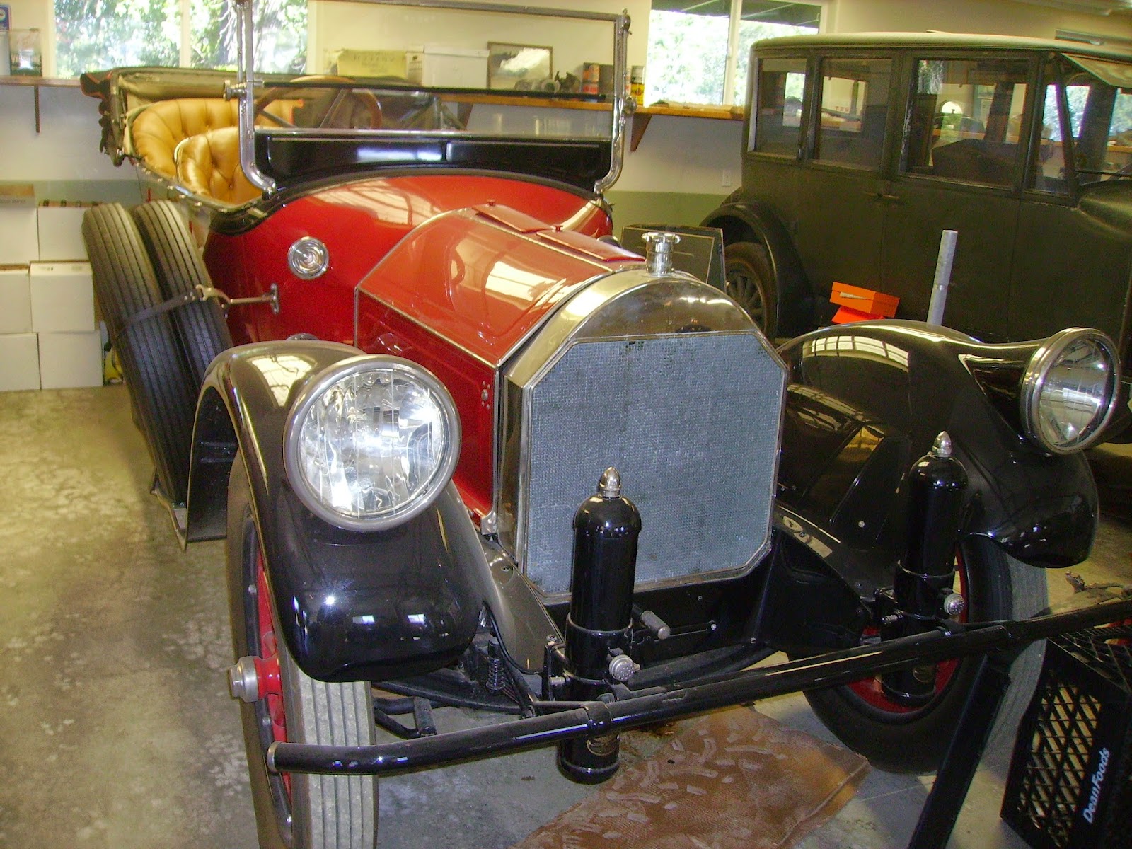
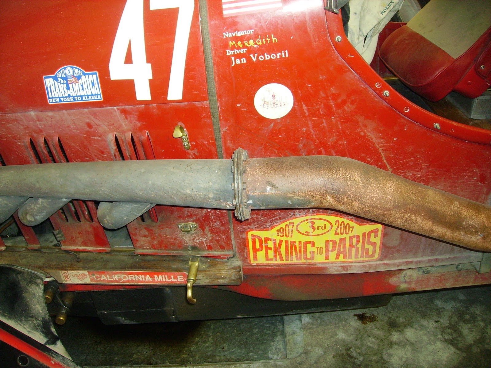
The next day, we hit a Mexican bakery in Soledad called La Plaza. Excellent shrimp tacos and pan dulce. Nice light fare again, because we were having a BBQ that night at a local winery. If it was possible to top the Basque place, this ran close. Local San Miguel fireman Scott was the grill master, serving up tender tri-tip, beans, salad and garlic bread. Michelle, the owner’s daughter played hostess with the mostest, and in good old Car Night fashion, her dad’s “barn” was open and OH MAN, what a sweet little collection of cars! A Type 35B Bugatti, a Fronty engined Indy Car and the Lancia Jan ran in the Peking to Paris Race in 2007. AMAZING!


The third day was another food fest, Jocko’s for lunch. Only the best steak on the planet! Whooooboy. Not eating for the rest of the week!
As far as the roads, I don’t think it’s possible to find better driving roads than the Central Coast of California in the spring. Tight twisties? Got ‘em. High Speed Sweepers? Got ‘em. Rolling hills covered with green velvety grass and wild flowers and dotted with oak trees? Got ‘em. Long, lonely roads with no traffic? Got ‘em! Add neat cars and a great bunch of people and you can’t go wrong. We even survived the climb to the top of what one guy called “The World’s Longest Driveway” to the top of the mountains behind Santa Barbara. And the view was worth it!


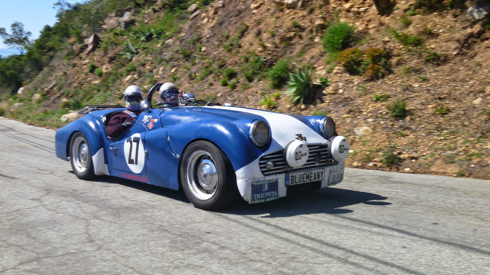
I’d really like a chance to show off these roads to those prats on Top Gear. I’m issuing a challenge. Buy three British sports cars, pre-1970 or so and drive with us. Who needs a Veyron or a 911 GT3 when you can actually have FAR more fun in a TR3? I’d further have them reenact some of the challenges that Brit cars have inflicted on us over the years. Start with a “simple” tyre change, then, re-gap the points, then deal with a balky control box or (gasp) and SU Fuel Pump. Toss in some random Lucas glitches and Hey Presto, a great show.


I had a reader ask about why I don’t do the Go Pro route on these drives. He tried to follow on the ground view of Goggle Maps and got tired of a marathon mouse-click-a-thon. I can’t blame him. However, Go Pros cost a fair amount and I can get stuff like tyres or gas instead. Plus, why collect evidence that can be used against you?

The best part was of course the people. From our friends Graham and Fay from Australia, to the usual suspects, to the first timers, this group of about 25 were great to have along. Part of that is the fact that it was only 25 or so people. One of the problems with the old Iron Bottom was that it got too damn big. The last one had some 120 cars! What happens is that cliques form. You get to talk with fewer people. On the last one, a group of snobs rented a LIMO to go to dinner on their own, not wanting to join the rest of us. Most eateries can handle 20-25 people as a group. Eating together, staying at the same cheap-ass motel, bullshitting the night away, THAT’S what makes this truly enjoyable. So, my advice to any of you who want to organized this kind of motorized folly is to 1) keep the group in the range of 20-30 people. 2) pick great places to eat together, 3)stay at the same cheap motel, 4) let everyone go at what ever pace they want. It’s the camaraderie that matters, everyone’s car is Cool, everyone has fun. 

Tuesday, April 1, 2014

Road Trippin’ 
with Steve McCarthy

Day Three of our Further Adventures Along the Central Coast will involve the usual eclectic nature of California backroads and the best damn steak you’ve ever had! Yes, folks, that means Jocko’s in Nipomo. It’s not really that far away, so you can sleep in, get a small breakfast (save room for STEAK!) and take a leisurely pace. 


I’ve talked about Jocko’s before, but it bears repeating. The place has been there since 1898 or so, Jocko sold bootleg booze during Prohibition, and the place looks like a dive bar. Inside, the decor is late 60s at best. Don’t let that fool you! Without a doubt, they make the best steaks ever. All locally raised and dressed, then grilled over an oak fire, they are tasty and tender. The sides (salad, beans and fries or baked spud) are equally good. We took my sister and her husband there a couple of weeks ago and they were stunned at how good and fresh it all was. An added bonus is the price! The four of us ate there (with wine) for $100!!!  Be prepared for a wait. Without reservations, it can take an hour at dinner time. Lunch a bit less so, but don’t be put off! Although they have chicken and ribs that are good, just eat the steak and don’t bother bringing vegetarians! 

This drive also takes us down one of my favorite roads, Bitterwater Road, from the 46 to the 58. This is a GORGEOUS stretch of road, flanked with rolling green hills dotted with wild flowers (in the spring that is!) and lots of oak trees. DO BE CAREFUL! Parts of it are open range, so be prepared to meet something that will wind up on your plate at Jocko’s a bit earlier than you may want to. 
After lunch is 166, then the back way to the I-5 through Frazier park, then home. Highway 166 is often patrolled, so have your radar detector at the ready! 
All in all, this is a pleasant three day drive that has a variety of challenges, terrain, and scenery. I know you’ll like it. 

DAY THREE
Western States Inn San Miguel
1099 K St
San Miguel, CA 93451

1. Head north on K St toward 12th St 0.3 mi
2. Take the 3rd right onto 14th St 0.2 mi
3. Continue onto N River Rd 4.7 mi
4. Turn left onto Wellsona Rd 2.3 mi
5. Turn right onto Airport Rd 2.3 mi
6. Turn left onto Dry Creek Rd 2.1 mi
7. Continue straight onto Jardine Rd 0.2 mi
8. Turn left onto CA-46 E 2.3 mi
9. Turn right onto Geneseo Rd 5.3 mi
10. Turn left to stay on Geneseo Rd 2.1 mi
11. Slight left onto Creston Rd 3.0 mi
12. Turn left onto CA-41 N 12.9 mi
13. Turn right onto W Centre St 2.7 mi
14. Turn right onto CA-41 N/CA-46 E 4.2 mi
15. Turn right onto Bitterwater Rd 9.1 mi
16. Turn right onto Annette Rd/Bitterwater Rd
Continue to follow Bitterwater Rd 22.4 mi
17. Turn right onto CA-58 35.6 mi
18. Continue to follow CA-58 W 1.3 mi
19. Turn right onto CA-58 W/Estrada Ave 0.3 mi
20. Turn left onto CA-58 W/El Camino Real/G St
Continue to follow El Camino Real 1.8 mi
21. Take the ramp onto US-101 S 7.5 mi
22. Take the exit toward Monterey St 0.1 mi
23. Turn left onto Buena Vista Ave 0.1 mi
24. Slight left onto Garfield St 85 ft
25. Turn right onto Monterey St 0.6 mi
  1. Turn left onto Johnson Ave 2.1 mi
27. Slight left onto Orcutt Rd 1.0 mi
28. Turn left to stay on Orcutt Rd 8.0 mi
29. Turn right onto Lopez Dr 2.7 mi
30. Continue onto Huasna Rd 1.6 mi
31. Turn left onto E Branch St 0.8 mi
32. Crossover 101 0.2 mi
33. Turn left to merge onto US-101 S 4.9 mi
34. Take the Los Berros Road exit toward Thompson Avenue 0.3 mi
35. Turn left onto Los Berros Rd 276 ft
36. Continue onto N Thompson Ave


Destination will be on the right 3.1 mi
148 mi – about 3 hours 33 mins

Jocko's
125 N Thompson Ave
Nipomo, CA 93444


37. Head southeast on N Thompson Ave toward E Tefft St 4.1 mi
38. Turn left onto CA-166 E 62.0 mi
39. Turn right onto CA-33 S 20.0 mi
40. Turn left onto Lockwood Valley Rd 26.8 mi
41. Turn right onto Frazier Mountain Park Rd 6.9 mi
42. Turn right to merge onto I-5 S toward Los Angeles 44.4 mi
43. Take the exit onto I-210 E toward Pasadena You can find home from here! 


176 mi – about 3 hours 24 mins